Topoplan
nanoCAD’s Topoplan module enhances the nanoCAD platform with tools for digital terrain modeling and documentation, making the work of surveyors more efficient. The nanoCAD platform offers a comprehensive set of basic and advanced design tools for creating and editing 2D/3D objects, providing multiple drawing and editing methods for most geometric elements. It serves as the foundation for building a more powerful CAD system tailored to your specifications.
New in Topoplan
The Topoplan module extends the nanoCAD platform with advanced tools for digital terrain modeling and documentation, designed to enhance the efficiency of surveyors. Key new features include:
Main features
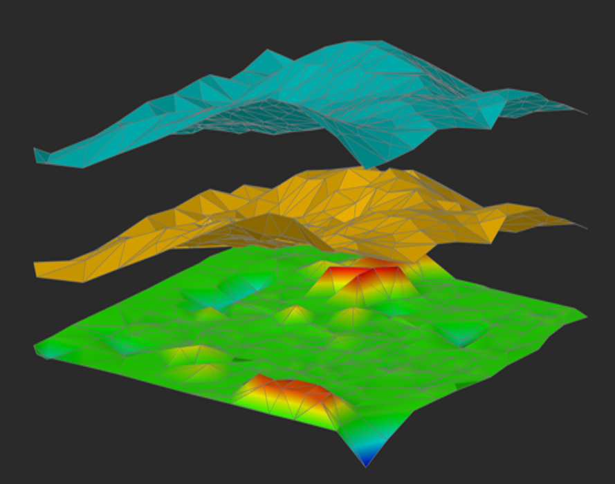
Surface Difference
The Height Difference (NG_HEIGHT_DIFFERENCE) command creates a new surface by subtracting one surface from another.
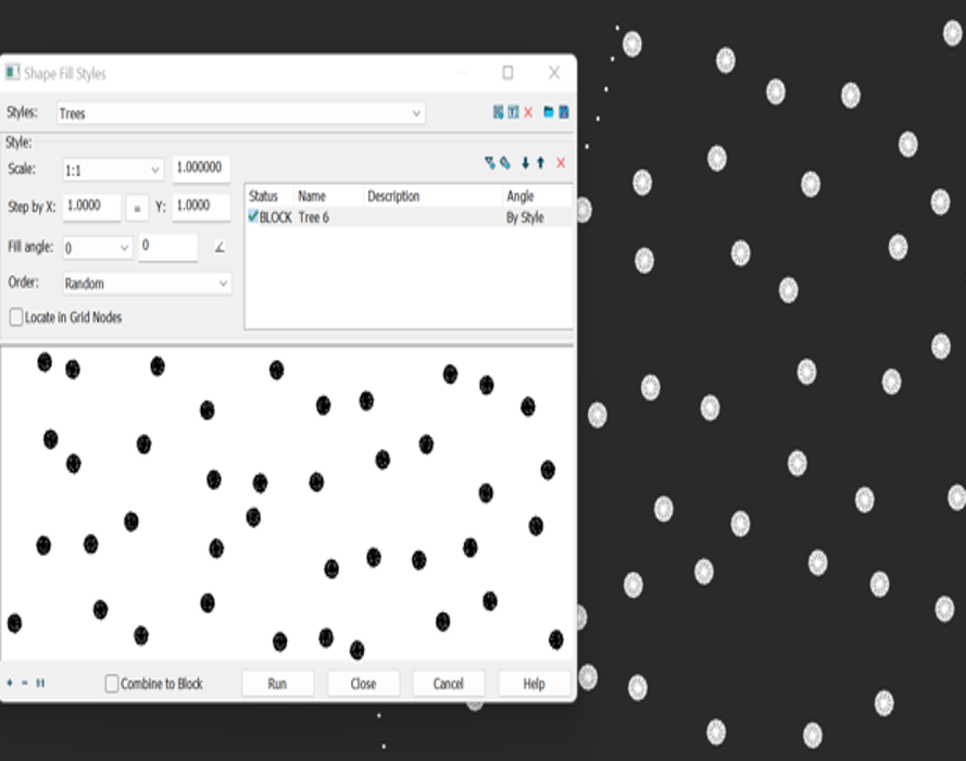
Topographic Hatches
Fill contours with conventional signs. You can set the type of filling, step, angle of rotation, and combine several symbols.
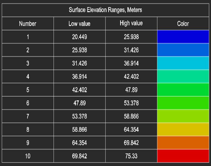
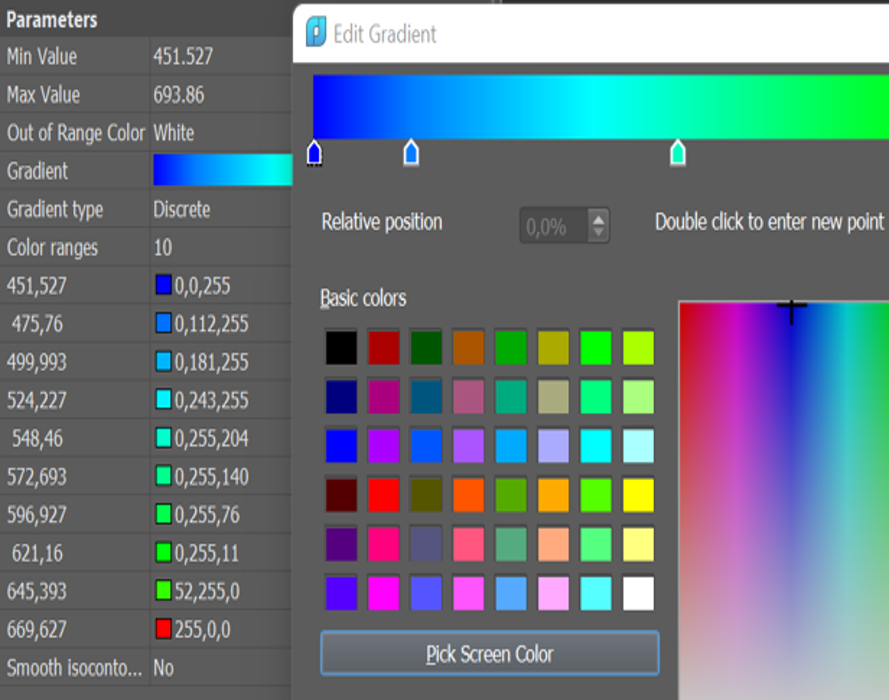
Coloring Elevation Legend
Generate an elevation legend for a height-colored surface.
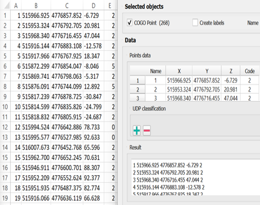
Export Geopoints
The Export Geopoints (NG_EXPORT_POINTS) command allows you to export objects such as geopoints, blocks, and simple points to txt, csv, and sdr formats. It also enables creating labels in the drawing, saving the label’s rotation value or other user attributes when exporting to an external file, and selecting encoding.
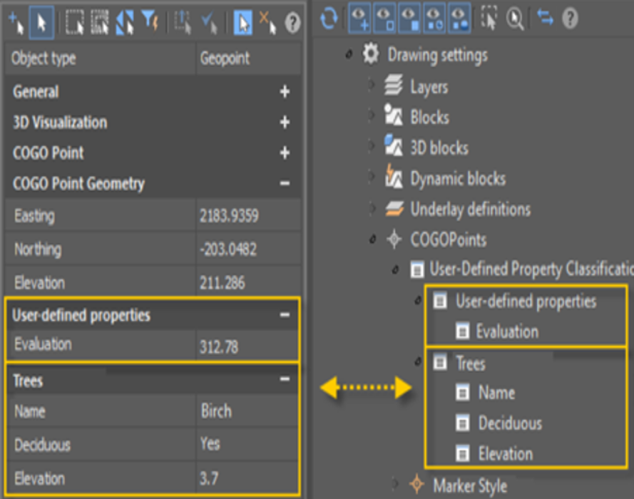
User-Defined Properties of Geopoints
Set user-defined properties for geopoints. If you have additional data that cannot be distributed over existing standard geopoint properties, you can define your own user-defined properties.
Painting Mesh by Elevation
Expanded options for coloring the surface by elevation. Customize, save, and load the gradient from a file.