Raster
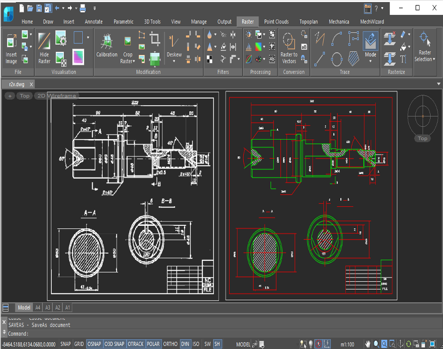
nanoCAD’s Raster Module enhances the nanoCAD platform with tools for importing, correcting, and vectorizing raster images. The nanoCAD platform offers a comprehensive set of basic and advanced design tools for creating and editing 2D/3D objects, providing multiple drawing and editing methods for most geometric elements. It serves as the foundation for building a more powerful CAD system tailored to your specifications.
Automatic vectorization
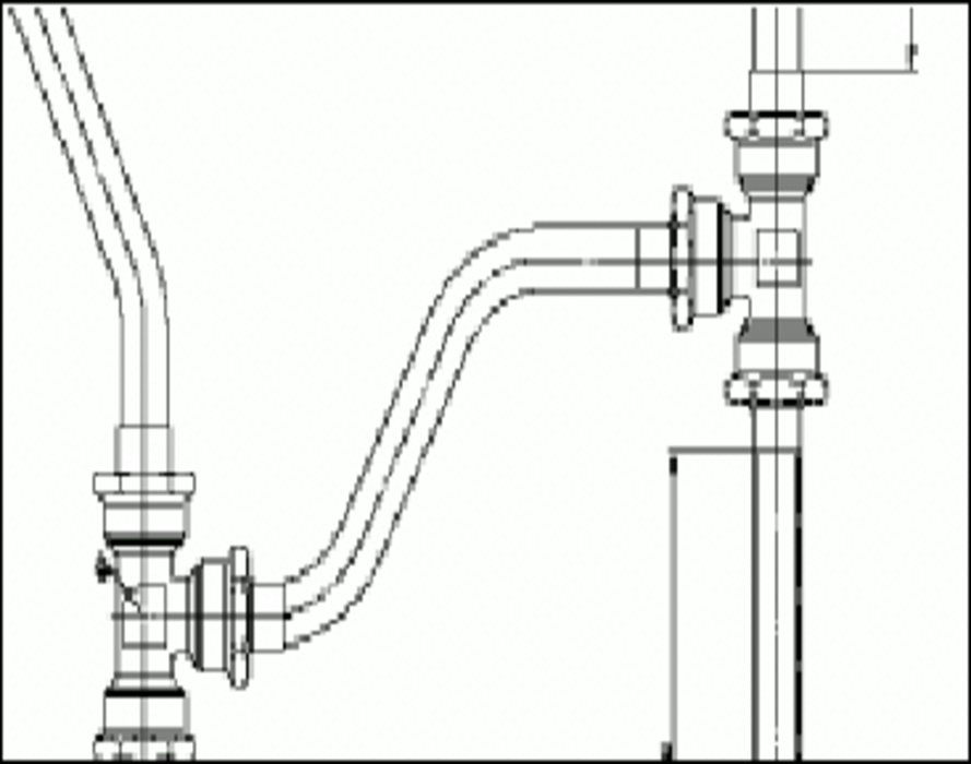
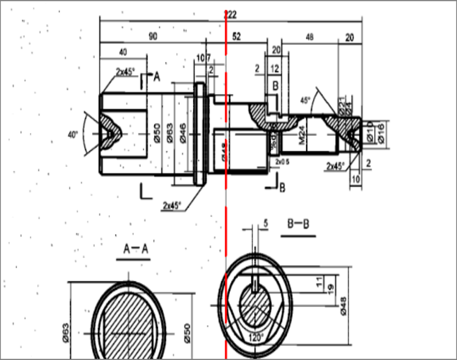
The Raster Module converts raster images into vector objects by recognizing entities such as points, lines, arcs, circles, hatches, texts, symbols, and outlines. At the end of the vectorization process, lines, circles, arcs, polylines, and arrowheads are recognized as object types.
Raster Features
Monochrome Filtering
The Raster Module offers a variety of monochrome filters, including smoothing, thinning, thickening, removing speckles, filling holes, generating contours, and inverting images. These filters not only improve image quality but also significantly reduce the size of raster files.
Correcting Image Geometry
The Raster Module corrects geometric distortions in raster images, whether monochrome, grayscale, or color. Key features include:
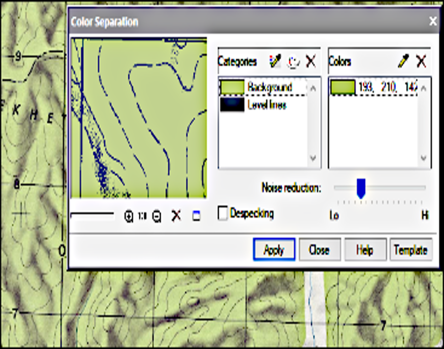
Color Reduction and Separation
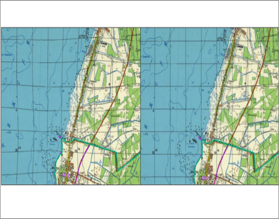
The Raster Module separates objects of different colors (such as roads and rivers) onto their own monochrome layers. This technique is more efficient than making black-and-white scans of color images.
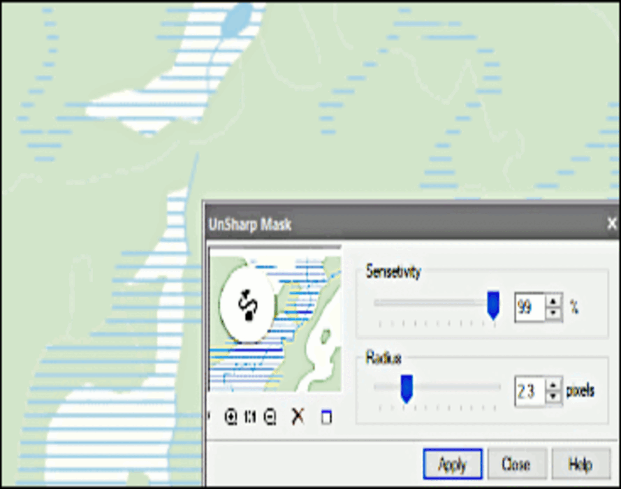
Color Filtering
The Raster Module’s color filtering tools prepare images for subsequent operations. Color filtering improves image quality after operations that move entities in the image or change the resolution through scaling, alignment, rotation, calibration, and four-point correction. Tools in color filtering include:
Rasterization
The Raster Module rasterizes and merges selected vector and raster data onto underlying raster images. The selection can consist of raster images and/or CAD objects.
Raster Image Selections
The Raster Module selects portions of raster images and transfers them to new raster images on specified layers. Selections can include: